
Press Release Read More
CGG Announces its 2019 Third Quarter Results
Paris, France | Nov 6, 2019Strong operational performance & cash flow generation drive leverage ratio below 1x
Solutions for complex energy transition, natural resource and environmental challenges.

Accelerate workflows and make better-informed business decisions

Meet a variety of industry challenges using CGG's insight and experience

Download our Corporate presentation to have a global view of our plans, strategies and prospects
View PresentationStrong operational performance & cash flow generation drive leverage ratio below 1x
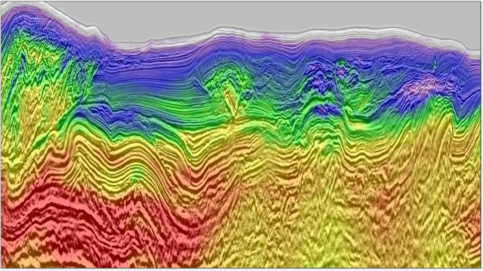
CGG Subsurface Imaging, part of CGG’s Geoscience division, has delivered state-of-the-art broadband 4D seismic results ahead of schedule from BP Angola’s latest monitor survey offshore Angola. This achievement builds on previous 4D seismic processing projects undertaken for BP Angola.
CGG announced today that its Geoscience division has completed, five months early, the multi-year integrated geoscience study awarded by Kuwait Gulf Oil Company (KGOC) in early 2017. The study’s main objective was to identify resource growth potential in the mature, onshore Partitioned Zone (PZ).
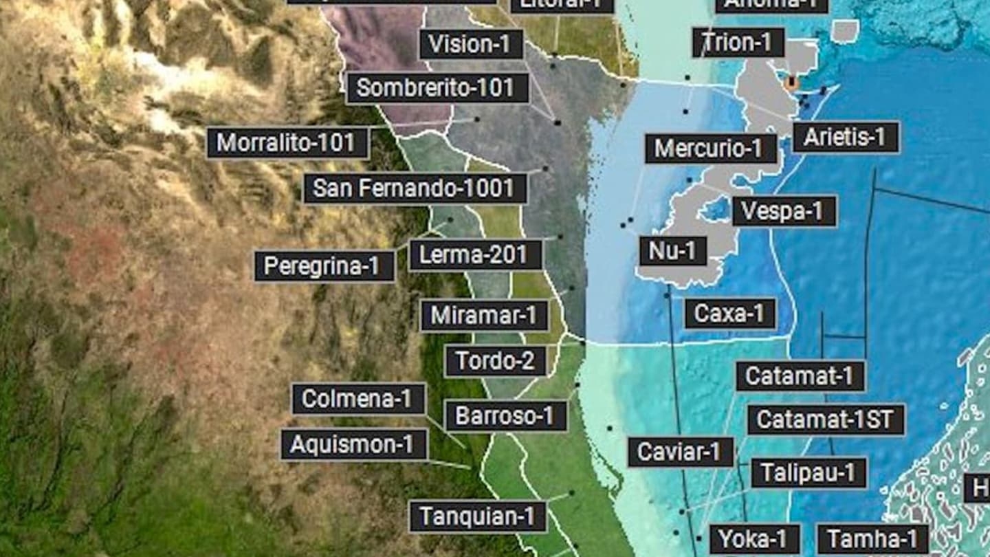
Booming hydrocarbon production in the Permian basin over the last few years allowed the United States to become, once again, one of the world’s top exporters.
CGG GeoSoftware, part of CGG’s Geoscience division, has announced that machine learning technology in Python ecosystems will be available in upcoming releases of its flagship HampsonRussell and Jason reservoir characterization solutions.
Machine learning continues to make the headlines at industry events this year with dedicated workshops and technical sessions.
CGG announced today that Sercel has launched WiNG, a fully integrated wireless nodal acquisition system that combines optimum field operational efficiency with the highest level of data quality available to support the most precise imaging needs of the land seismic industry.
Investment in deepwater exploration and development is on the rise. Although the often prolific subsalt plays offer high rewards for explorers, they can bring potentially higher development costs and risks.
CGG announced today the launch by Sercel of GPR, a new Ocean Bottom Node (OBN). GPR leverages the proven high performance of Sercel’s QuietSeis® broadband digital sensor technology to collect superior data for accurate seismic imaging compared to data collected by conventional sensors.